대표어
대표어

권호기사보기
| 기사명 | 저자명 | 페이지 | 원문 | 기사목차 |
|---|
결과 내 검색
동의어 포함
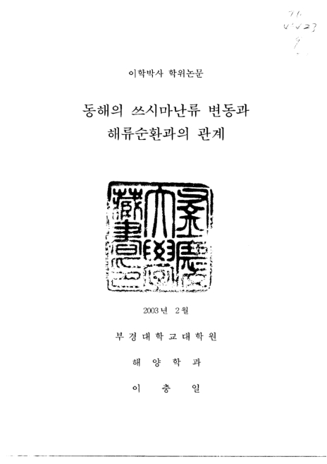
표제지
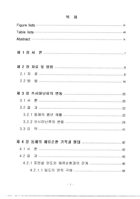
목차
Abstract 12
제 1 장 서론 14
제 2 장 자료 및 방법 22
2.1 자료 22
2.2 방법 27
제 3 장 쓰시마난류의 변동 33
3.1 서론 33
3.2 결과 35
3.2.1 동해의 평년 해황 35
3.2.2 쓰시마난류의 변동 42
3.3 요약 54
제 4장 동해의 해류��환 기작과 형태 55
4.1 서론 55
4.2 결과 58
4.2.1 포텐셜 와도와 해류순환과의 관계 58
4.2.1.1 밀도의 연직 구배 58
4.2.1.2 수평방향의 해류 순환 63
4.2.1.3 연직방향의 해류 순환 73
4.3 요약 79
제 5 장 총괄 80
5.1 고찰 80
5.1.1 쓰시마난류의 변동과 해류순환과의 관계 80
5.1.2 엘니뇨와 쓰시마난류 변동과의 관계 89
5.2 결론 94
감사의 글 95
참고문헌 96
Appendix 103
Fig 1.1 Map of northwest Pacific. the abbreviaion K/S,T/S,S/S,ECS, NPO and S/O indicate Korea-Tsushima Strait, Tsugaru Strait, Soya Strait, East China Sea, North Pacific Ocean, and Sea of Okhotsk, re)spectively, Numerals indicate depth(m 15
Fig 1.2 Schematic view of the origin of the Tsushima Warm Current as a part of the Taiwan-Tsushima Warm Current System (a) and a separation branch of the Kuroshio (b) Numerals on the solidlines show the depth in meter(lsobe, 1999) 16
Fig 1.3 Schematic diagram showing cr\urrent pattern in the East Sea (Naganuma,1973: Yurasov and Yarichin, 1991:Senjyu,1999) Abbreviation TWC, P and L represent Tsushima Warm Current(1st, 2nd, 3rd branches) Polar front, Noth Korea Cold Current,respectivel 17
Fig 1.4 Schematic chatrr showing the two types of the nothern boundary of the Tsushima Watm Current(TWC)in Summer during 1970 to 1979 (Hong and Cho, 1983) 19
Fig 1.5 Horizontal distribution of the diurnally sveraged current in 1995 (top) and 1997 (bottom) Temperature distribution at 100m in early June of 1995 and 1997 are superimposed, respectively Contour interval is 1.0℃ (Hase et.al 20
Fig 2.1.1 The map showing study area and bathymetry. Lines D,PM. F and G represent serial station of JMA and symbol star(★)` indicate serial station of NFRDI Numerals indicate the station nymber of each observation line 23
Fig 2.1.2 Station location chart. Field observation was carried out by multi-ship survey of JMA from September 29, 1969 to OctoberOctober19, 1969, Ryofu Maru, Lofu Maru, Shumpu Maru, Chofu Maru and Seifu Maru are the name of research vessel 26
Fig 2.1.3 The map showing SOI and NINO3 SST data collection area 27
Fig 2.2.1 Schematic diagram showing the theory of potential voricity conservation The upper figure shows the change of rotation directin of water column through the variation of thickness and width to conserve its potential vorticity. The lower figure fi 30
Fig 3.2.1 Horizontal distribution of mean temperature at 0m, 50m, 100m and 200m in February during 30years from 1966 to 1995 36
Fig 3.2.2 Horizontal distribution of mean temperature at 0m, 50m, 100m and 200m in August during 30years from 1966 to 1995 37
Fig 3.2.3 Horizontal distribution of standard deviation of temperature at 0m, 50m, 100m and 200m in february during 30years from 1966 to 1995 40
Fig 3.2.4 Horizontal distribution of standard deviationof temperature at 0m, 50m, 100m and 200m in August during 30years from 1966 to 1995 41
Fig 3.2.5 T-S diagram of water masses observed along lines D,PM,F and G in Februaty, April,June and October of 1996 43
Fig 3.2.6 Time series of temperature (a), salinity (b) and dissolved oxygen (c) at the sea surface of each station along PM line from 1972 to 1999 45
Fig 3.2.7 Time series of temperature (a) salinity (b) and dissolved oxygen (c) at 100m of each station along PM line from 1972 to 1999 46
Fig 3.2.8 Time series of temperature (℃) at 100m of each staion along PM-line in Februay (a) and July (b) from 1972 to 1999 48
Fig 3.2.9 Time series of salinity (psu) at 100m of each station along PM-line February (a) and July (b) from 1972 to 1999 49
Fig 3.2.10 Time series of dissolved oxygen (micro-mol/l) at 100m of each station along PM-line in February (a) and July (b) from 1972 to 1999 50
Fig 3.2.11 Time series of temperature deviation at 100m of each station along PM line in February (a) and July (b) from 1972 to 1999 51
Fig 3.2.12 Wavelet analysis for temperature at 100m of st. 314-07 Solid lines shown in the lower panel `b` indicate 95% confidence level and dark red color in the inner part of solid lines nean higher varation of a given period Vertical dashed line drawn 52
Fig 3.2.13 Wavelet analysis for temperature at 100m of st 207-04 the same as Fig 3.2.12 53
Fig 3.2.14 Wavelet analysis for temperature at 100m of st 105-08 the same as Fig 3.2.12 53
Fig 4.2.1 Horizontal distribution of temperature (℃) at 100m measured by JMA from September 29 in 1969 October 19 in 1969 59
Fig 4.2.2 Section of temperature (a) and salinity (b) composed with thermosteric anomaly along lines A5 61
Fig 4.2.3 Section of temperature composed with thermosteric anomaly along lines A3 (a) and A8 (b) 62
Fig 4.2.4 The distribution of potential vorticity (�10 -10cm�s-�)computed between thermosteric anomaly=200 and termoxteric anomaly=300 surface Shaded regions indicate eddies 64
Fig 4.2.5 The distribution of potential vorticity (�10 -10cm�s-�)computed between thermosteric anomaly=100 and aly=200 and thermosteric anomaly=200 surface 65
Fig 4.2.6 The distribution of potential vorticity (�10 -10cm�s-�)computed between thermosteric anomaly=80 and thermosteric anomaly=100 surface Sheaded regions indicate eddies 67
Fig 4.2.7 The distribution of potential vorticity (�10 -10cm�s-�)computed between thermosteric anomaly=74 and thermosteric anomaly= 80 surface Shaded refions indicate eddies 68
Fig 4.2.8 The distribution of potential vorticity (�10 -10cm�s-�)computed between thermosteric anomaly=72 and thermosteric anomaly= 74 surface Shaded refions indicate eddies 69
Fig 4.2.9 West and easward flow (a) and north and southward flow (b) of geostrophic current (cm/sec) at sea surface 71
Fig 4.2.10 West and easward flow (a) and north and southward flow (b) of geostrophic current (cm/sec) at 100m 71
Fig 4.2.11 West and easward flow (a) and north and southward flow (b) of geostrophic current (cm/sec) at 200m 72
Fig 4.2.12 West and easward flow (a) and north and southward flow (b) of geostrophic current (cm/sec) at 400m 72
Fig 4.2.13 West and easward flow (a) and north and southward flow (b) of geostrophic current (cm/sec) at 600m 73
Fig 4.2.14 Section of geostrophic current (cm/sec) along line A5 shaded areas indicate westward flow and arrows indicate clockwise and antkclockwise rotation respectively 75
Fig 4.2.15 Vertical distribution of temperature, salinity, dissolved oxygen and phosphate in the northern part of the East Sea 77
Fig 4.2.16 T-S diagram using data measured from JMA multi-ship survey in 1969TWC and ESPW indicate Tsushima Warm Current and East Sea Proper Water, respectively 78
Fig 5.1 Tome series of mean temperature in February (a) July (b) and yearly mean temperature (c) ag 100m along PM-line Arrows indicate the period shown in Figs 5.5-5.7 82
Fig 5.2 Horizontal distribution of mean temperature (℃) from 1904 to 1984 at 100m in Frbruary 85
Fig 5.3 Horizontal distribution of mean temperature (℃) from 1904 to 1984 at 100m in august 85
Fig 5.4 Horizontal distribution of mean temperature (℃) at 100m from September to October in 1969 86
Fig 5.5 Horizontal distribution of mean temperature (℃) at 100m in February of 1989 shaded areas indicate eddies 87
Fig 5.6 Horizontal distribution of mean temperature (℃) at 100m in February of 1989 Shaded areas indicate eddies 87
Fig 5.7 Horizontal distribution of mean temperature (℃) at 100m in February of 1982 Shaded areas indicate eddies 88
Fig 5.8 Wavelet analysis for SOI Solid lines shown in the lower panel`b` indicate 95% confidence level and dark red color in the inner part of the solid lines mean higher variation of a given period Vertical dashed line drawn in the lower panel `c` indic 91
Fig 5.9 Wavelet analysis for NIN03 SST the same as Fig 5.8 92
Fig 5.10 Cross spectrum between SOl and temperature at 100m of st 207-04 93
*표시는 필수 입력사항입니다.
| 전화번호 |
|---|
| 기사명 | 저자명 | 페이지 | 원문 | 기사목차 |
|---|
| 번호 | 발행일자 | 권호명 | 제본정보 | 자료실 | 원문 | 신청 페이지 |
|---|
도서위치안내: / 서가번호:

우편복사 목록담기를 완료하였습니다.
*표시는 필수 입력사항입니다.
저장 되었습니다.